Prime
Influences on spatial development from major projects on land

What you need to know:
- To some extent, this is a result of the fixed location of land. Infrastructural developments for example, have a fundamental impact on land values; and can lead to the opening up of new areas.
The opening of the 3 km Magufuli Bridge, connecting the Usagara-Sengerema-Geita Highway across Lake Victoria, and the longest in East Africa is certainly a game changer, linking Tanzania to zonal and regional markets. It is destined to bring about fundamental changes not just in transport but in the whole approach to doing business in the Region.
Land economists are agreed that the land market is imperfect and that government intervention is essential. Such intervention may take many forms including: action related to land tenure, land registration and transfer, land taxation, land use regulation, land acquisition and direct intervention by public authorities. This latter, includes infrastructure provision such as roads and highways.
The private sector cannot of its own be expected to construct a bridge such the one the government has just completed, the Magufuli Bridge. Such infrastructure has both macro and micro economic fallouts, generally beneficial to the nation and its people.


A World Bank Economist of yester-years, J.M. Courtney, pointed out in 1983, that sometimes, such action on land may have unintended, and many times, unforeseen influences on spatial development, and the use of land. For example, construction of a national highway or bridge can lead to fundamental effects on land uses and land values.
To some extent, this is a result of the fixed location of land. Infrastructural developments for example, have a fundamental impact on land values; and can lead to the opening up of new areas.
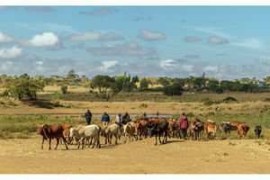
For example, historically, with respect to the City of Dar es Salaam, it can be pointed out that the construction of a bridge over the Msimbazi River along Morogoro Road in 1953 as part of the Tanga-Dar es Salaam Road, helped the opening up of the Magomeni area. Radial roads out of Dar es Salaam such as Kilwa Road, Pugu Road, Morogoro Road, and Bagamoyo Road, meant to take traffic elsewhere, all influenced the siting of Industrial areas in the city, as did the construction of the Port Access Road in 1980, originally meant to divert heavy port and upcountry traffic from the city centre.The latter led to the opening up of areas like Tabata and Segerea.
An example from my early childhood may illustrate the point. This was the construction of a bridge over the Kagera River in 1968. Before that, crossing the River Kagera was by way of a manual cable stayed ferry. As youngsters, we really enjoyed seeing ferry workers treading the cable and getting the ferry forward, much it was loaded with people and vehicles.
The ferry crossing had spatial impact on the Kyaka trade centre. Shops lined the ferry approach road. Business was vibrant targeting passengers and vehicle drivers as they waited for their turn to board the ferry.
In 1968, all this changed since the bridge was constructed some distance from where the ferry was. Besides that, passengers and motor vehicles no longer stopped at Kyaka as a matter of necessity. They would just zoom past, rushing to their destinations.
An unforeseen fall out happened. The shops and economic activities that were aligned with the ferry went into decline. Properties were abandoned. Indeed, some well-know traders moved away from Kyaka or relocated to new sites that were now promising for new kinds of business.
If you were to visit Kyaka today, you will see many abandoned buildings some, in ruins, formerly related with the ferry; while a new Kyaka is flourishing elsewhere.
Clearly, the Kigongo-Busisi bridge will come with new changes to the use of space and local business. Vehicles loaded with passengers or goods will no longer be stopping there, the way they used to, so business people need to re-orient themselves and take advantages of the bridge. Investments in food business, in lodges, in hospitality and petty trading on the ferry may take a jerking. It should be remembered that it could take hours of waiting before boarding the ferry and crossing the arm of the land Victoria.
Buses and other vehicles, that used to stop for a long time may be tempted to speed on with their journey and end up stopping somewhere else away from the bridge. This means shifting business and employment elsewhere.
Public authorities may want to come in here and see whether current businesses which depended on the ferry will get a hitting, and, should that be the case, design ways to help them to readjust.
On the other hand, new forms of business, including tourism could be engendered, may be bringing in new actors.
Whichever way matters go, the economic actors of Kigongo-Busisi should be on the look out for changes and adjust themselves accordingly. Infrastructure development projects usually come with micro-economic effects which impact on the use of space. Being prepared for adjustment is the way forward.