Arusha. Tanzania is poised to enter global geological records following scientific confirmation that Mount Meru hosts one of the largest volcanic debris avalanche deposits ever documented worldwide.
According to conservation authorities and researchers, the extensive volcanic debris formations at the base of Mount Meru represent a major geological feature likely formed nearly 9,000 years ago during a powerful volcanic collapse.
The Conservation Officer in charge of Tourism at Arusha National Park, Mr Jerome Ndazi, explained on Wednesday, April 8, 2026, that the debris avalanche deposits (DEADE) have shaped the surrounding landscape into a series of hills and distinctive geological formations around the mountain.
Mr Ndazi said scientific studies indicate the volcanic material was deposited following a major eruption and structural collapse of the Meru volcano thousands of years ago.
“The same geological processes contributed to the formation of key features within Arusha National Park, including Ngurdoto Crater, the Momella Lakes, and Tululusia Waterfall, all now major park attractions,” he said.
Conservation officials said the vast debris avalanche landscape presents significant opportunities for geotourism development in Tanzania, particularly for geological researchers and international visitors interested in volcanic landforms.
The area has also been identified as a potential candidate for designation as a UNESCO Global Geopark.
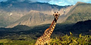
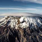
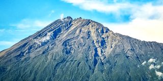
Mount Meru, now dormant, is Tanzania’s second-highest mountain after Mount Kilimanjaro and ranks among Africa’s most prominent volcanic peaks.
It lies within the Northern Tanzanian Divergence Zone, part of the eastern branch of the East African Rift System.
The 4,565-metre-high volcano is characterised by a large horseshoe-shaped scar on its eastern flank, formed by a massive collapse event linked to the ancient Momella debris avalanche about 9,000 years ago.
Scientific studies combining remote sensing and detailed field mapping have helped researchers better understand the structure, texture, and distribution of the deposit.
The landscape features hummocks, ridges, lobes, grabens, and shear zones, indicating complex emplacement processes.
Researchers have also identified different geological facies within the deposit, including mixed facies with both indurated and fragmented rock, as well as matrix-supported materials.
Studies suggest the collapse involved a volume exceeding 20 square kilometres, with debris spreading across an estimated 1,250 square kilometres, reaching as far as Mount Kilimanjaro’s foothills.
Evidence indicates water played a significant role in influencing the avalanche’s mobility and deformation, particularly through a water-saturated basal layer that facilitated movement and structural change during emplacement.
Recent research has been undertaken by scientists, including Audray Delcamp and Matthieu Kervyn of Vrije Universiteit Brussel, Mhammed Benbakkar of Université Clermont Auvergne, and Shimba Daniel Kwelwa of Ashanti-Geita Gold Mine.
Geologist Roger N. Scoon of Rhodes University noted that the Meru caldera collapse and Momella event can be compared to the catastrophic 1980 eruption of Mount St. Helens in the United States, although the Meru event was significantly larger.
He explained that the avalanche reshaped the surrounding terrain, including the formation of the Momella Lakes, now important habitats for migratory birds.
The surrounding montane forests on Mount Meru’s slopes remain ecologically rich, providing refuge for large mammals and numerous bird species, further enhancing the mountain's environmental and tourism value.
Register to begin your journey to our premium contentSubscribe for full access to premium content